This post may contain affiliate links. I will receive a small commission if you use these links.
What’s the first thing that pops into your mind when you think of Thailand? Colourful temples? Gorgeous beaches? Vibrant nightlife? Hiking trails?…perhaps not.
But there’s actually an abundance of beautiful hiking trails throughout Thailand.
If you’ve read some of my other blogs, or follow me on instagram, you’ll know that I love hiking! I always incorporate a couple of hikes or walks into any trip I plan. For me, it’s the best way to experience the landscape and nature of a new place.
If you’re planning a trip to Thailand, I’d encourage you to step onto a hiking trail and see some of Thailand’s raw beauty for yourself. There’s so many beautiful places, it would be a shame not to! And, you don’t even have to walk that far to experience some of the most beautiful hikes in Thailand.
10 Unmissable hikes in Thailand
I’ve put together a list of 10 of my favourite hikes in Thailand. These are all day hikes or less (some only a couple of hours) and they range from easy – challenging, so you can take your pick!
Make sure you also check out my 50 essential tips for visiting Thailand and Southeast Asia for everything you need to know about travelling in this beautiful part of the world.
Now…Read on to discover 10 of the best hikes in Thailand!
Table of Contents
1. Doi Suthep Monks Trail, Chiang Mai - great day hike
Length: 6.6km (one way)
Duration: 3 – 4 hours (depending on how long you stop at the first temple)
Trail category: Uphill hike, moderate – challenging with unclear path at times
Start / Finish point: Start: Trailhead near Chiang Mai Zoo / Finish: Doi Suthep Temple
Doi Suthep Monks Trail overview
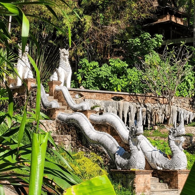
The Doi Suthep Monks Trail is one of the best day hikes in Thailand and an absolute must when visiting Chiang Mai. The trail leads you to two temples meaning that you can add a bit of culture into your hike too!
How to get to the Monk's Trail
The trailhead can be found just up the road from Chiang Mai Zoo. There’s a small amount of parking for scooters at the trailhead, but I would recommend getting a taxi or songthaew to the start. That way, you can get a taxi straight from the finish at Wat Doi Suthep back to your accommodation. You could also catch the R1 or R3 local bus to Chiang Mai university or Chiang Mai zoo and walk to the start from there.
There’s no admission fee to access the Doi Suthep Monk’s trail. This makes it one of the best free things to do in Chiang Mai. It is a challenging hike, especially in the heat, but worth it. Especially as you have the added bonus of visiting two beautiful temples.
Doi Suthep Monks Trail description
The trail starts with a gentle 1.5km upward hike to Wat Phra Lat. This section of the trail is well marked and the path is easy to follow. Make sure you stop for a while at Wat Phra Lat to explore this tranquil temple. Used as a resting point for Monk’s travelling to Wat Doi Suthep, Wat Phra Lat is much more subtle than other temples you may have visited in Thailand. You won’t find much gold leaf here, but the understated temple, nestled in the rainforest, is really peaceful and beautiful. Sit at the top of the small waterfall for views over Chiang Mai whilst you rest your legs.
If the hike up to Wat Phra Lat was enough of a challenge for you, this is your opportunity to shorten the hike and head back down the same path. Otherwise, it’s time to continue on and tackle the steepest section of this hike.
The trail between Wat Phra Lat and Wat Doi Suthep is more challenging than the first part. There are less hikers on this section of the trail and the route can be hard to follow and sometimes a tad overgrown, so make sure you have a route map with you. Soon you’ll arrive at the Monk’s housing, built on the side of Doi Suthep mountain, just below the temple. Follow the steps up to Wat Doi Suthep terrace for stunning panoramic views of Chiang Mai!
Make sure you spend a bit of time wandering around Wat Doi Suthep. It is one of the most popular temples in Chiang Mai, known for its large golden Chedi. Outside Wat Doi Suthep, you will find a large market stalls and plenty of shops and stalls to pick up a souvenir or grab a bite to eat. There’s also plenty of taxis waiting to give you a ride back into Chiang Mai.
2. Dragon Crest Mountain, Krabi - Challenging day hike with breathtaking panoramic views
Distance: 7.2km (total – out and back)
Duration: 2 – 4 hours (depending on your fitness level and stoppage time at the top)
Trail category: Uphill hike, physically challenging but easy route to follow
Start / Finish point: Khao Ngon Nak National Park Entrance
Dragon's Crest Trail overview
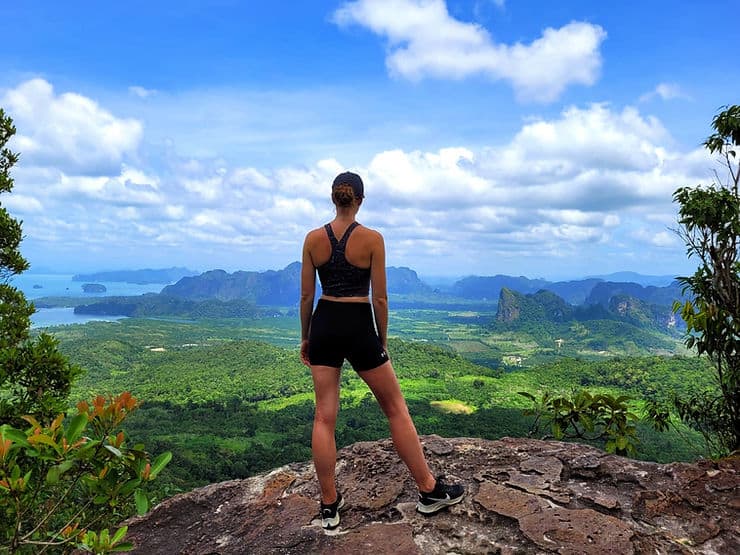
Taking on the Dragon Crest hiking trail might be one of the best things to do in Krabi, but it’s not for the faint-hearted! Locally known as the Khao Ngon Nak Nature Trail, the summit of Dragon Crest mountain is famous for its spectacular panoramic views of the surrounding limestone mountains and countryside. On a clear day, you can even see right out to the Andaman Sea!
Dragon Crest Mountain trail is a strenuous uphill hike, with some parts of the route very rocky and uneven underfoot. Flip flops or Birkenstocks are not going to cut it here, trainers or hiking boots are an absolute must to avoid ankle injuries. The trail is clearly marked, and easy to follow. It is a linear route, so you’ll come down the same way you ascend, starting and finishing at the entrance of the national park.
Whilst most of the trail ascends through the jungle, providing a decent amount of shade, it can still get very hot and sweaty during the dry summer months, so make sure you take plenty of water with you. I would also advise going earlier in the day to avoid the midday heat.
How to get to Dragon's Crest
The trail starts and finishes from the national park entrance. Here you will find toilets, and a small kiosk for cold drinks and ice creams afterwards! Entrance is 200 THB (£4.60) for foreigners / 40 THB for Thai locals. You can easily drive here, or take a taxi (just remember to book your return or take the driver’s number to arrange a ride back!). It’s 40 minutes drive from Krabi and 25 minutes from Ao Nang. If you are driving, enter ‘Checkpoint Mu Ko Phi Phi National Park’ into your google maps, rather than Dragons Crest Viewpoint or Dragons Crest Mountain.
Trail description
The constant uphill can be physically challenging but as long as you pace yourself, take breaks, and have a reasonable level of fitness, it is manageable. And, believe me, when you arrive at the top you will be thankful that you made the effort as the views are incredible! This is definitely one to add to your Thailand bucket list.
As you get closer to the top, you will start to get glimpses of the view through the trees, but the first official lookout you will arrive at is the Khao Ngon Nak Viewpoint. The view from here is impressive, but if you want the ultimate view, then you need to do a little more work by climbing over some boulders to reach the very top. I urge you to take great care if you choose to do this. There are no ropes, no barriers and the drop off the side of the mountain is scary high. We went part way up this final section and found a viewpoint which had amazing views but this was enough for me. The feeling of being so high and nothing to stop me falling was starting to make my legs shake!
Once you’ve taken in all the views and taken some epic photos at the summit, it’s time to go back down the trail. This can be tricky on the knees, but it’s much easier than the way up!
If you’re after a bit of a challenge and want to get some awesome mountain photos and stunning views, then the Dragon Crest Hiking trail is definitely not to be missed! in my opinion, it is one of the best short hikes in Thailand.
3. Kew Mae Pan Nature Trail, Doi Inthanon National Park
Distance: 3.4km circular trail
Duration: 1 hour
Trail category: Easy
Start / Finish point: Kew Mae Pan Nature Trail parking lot
Kew Mae pan trail overview
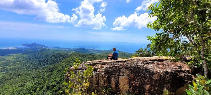
The Kew Mae pan nature trail is considered one of the most beautiful nature trails in Thailand and is very popular. The short route sits at the top of Doi Inthanon – the highest point in Thailand.
Being at the highest point in the country, it can get very cold at the top of Doi Inthanon, so make sure you pack layers with you. It is also advisable to avoid completing this walk during the months of March – May as this is known as ‘burning season’, where farmers burn their crops, creating a thick layer of smog and haze. This not only reduces visibility but it’s not great for breathing in.
How to get to Doi Inthanon
The Kew Mae Pan nature Trail is located in Doi Inthanon National Park, located 2 hours southwest of Chiang Mai. There is a designated parking lot at the start of the Kew Mae Pan Nature trail, where you can also find toilets. To walk on this trail you will need to hire a local guide, which you can do at the entrance. The cost is 200 THB (£4.60) per group (max 10 people).
If you don’t fancy a 2 hour scooter ride and don’t want to hire a car, you can join a group or private day trip to Doi Inthanon National Park from Chiang Mai.
Kew Mae pan trail description
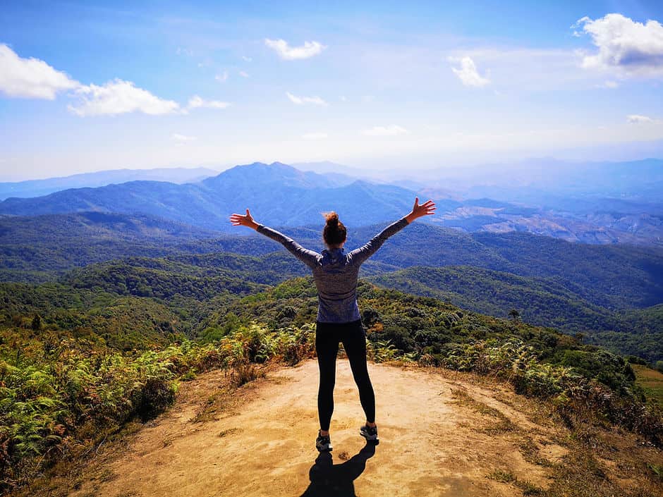
You start the short trail by following the clear paths and raised boardwalks through the rainforest. Soon enough the trail leaves the rainforest and you will walk out to stunning views of the surrounding mountain peaks and valley below. There is a viewing platform here, perfect for taking in the views and getting those photos!
Leaving the viewpoint, you will start to follow the ridge line of the mountain. This was my favourite part of the walk as the views from the ridge are just breathtaking! I had to keep reminding myself to watch where I was stepping as I couldn’t take my eyes away from the view! Soon enough you will arrive at another beautiful viewpoint. From here you can see the famous Royal Twin Pagodas. The pagodas were built to commemorate the previous King and Queen for the King’s 60th birthday. The pagodas are located just a few minutes drive from the nature trail parking lot and are worth a stop to admire the scale of them. Entrance to visit the pagodas is just 40 THB per person (£1).
The last section of the route will take you back through the rainforest and to the parking lot. This short nature trail is relatively easy and can be completed by most fitness levels, with very little ups and downs. The views are just incredible, you can certainly see why it is known as one of the most beautiful and popular hikes in Thailand.
Before you leave, make sure that you spend time visiting some of the other areas of Doi Inthanon National Park. As well as a visit to the Royal Twin pagodas, I would really recommend a stop at the Wachirathan Waterfall.
4. Na Mueang Waterfall hike - Best hike in Koh Samui
Distance: 2km (total – out and back)
Duration: 1 hour
Trail category: Moderate – Challenging
Start / Finish point: Elephant Kingdom car park or the small car park at the base of waterfall (difficult to access in conventional vehicle)
Na Mueang trail overview
If you’re looking for a great hike on Koh Samui, then look no further than the Na Mueang Waterfall hike! This hike is perfect if you want to feel a bit adventurous, without having to go off the beaten track. This there-and-back trail follows the Na Mueang waterfall from the base, right to the top, where you can have a dip in the small pool overlooking the surrounding landscape.
To be honest, even if you are not an avid hiker, this is definitely one of the best things to do on Koh Samui, especially if you are looking for some natural pools to cool off in.
How to get to Na Mueang
To reach the Na Mueang waterfall, you can either park in the Elephant Kingdom car park, or follow the track opposite the cafe which leads to the small car park at the base of the falls. This road is very hilly, so may not be suitable for inexperienced scooter riders.
There’s no admission to access the hiking trail, however there are a couple of cafes at the base where you can buy a cold drink and support the local community.
Na Mueang trail description
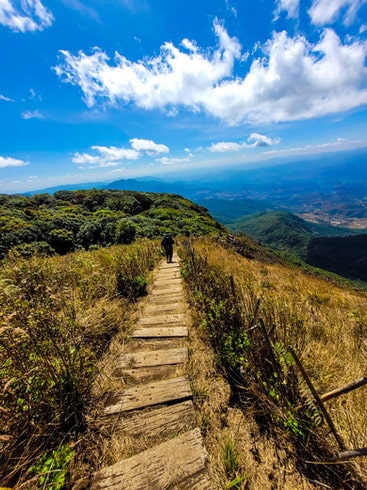
The trail is easy to follow, but the ground is very uneven. You will be walking uphill over tree roots, rocky paths and clambering over larger rocks. As you get closer to the top of the waterfall, the path becomes even steeper and there are ropes to help you over the trickier sections.
Make sure that you are wearing good trainers, or hiking shoes for this one and take plenty of water. Trust me when I say it’s a very hot and sweaty hike! The best time to hike the Na Mueang waterfall is between January – May, in the morning before it gets too hot. I would advise against taking on this hike during the wet season, or after heavy rain as some of the larger rocks could be very slippery and unsafe underfoot.
Don’t forget to bring your swimming suit so that you can take a quick dip in the refreshing pool at the top of the falls. From here, you’ll also be rewarded with beautiful countryside views.
This is one of the best things to do on Koh Samui and the natural pool at the top of the falls makes it even better!
5. Huay Kaew Waterfall, Chiang Mai - Short urban hike with picnic spot
Distance: 1km – 3km (depending on how far you walk align the trail)
Duration: 30 minutes – 1 hour (depending on how far you walk along the trail)
Trail category: Easy, there and back trail
Start / Finish point: Huay Kaew road, near Chiang Mai zoo
Huay Kaew trail overview
You don’t have to go far to escape the hustle and bustle of Chiang Mai. Just 6km outside of the city centre is Huay Kaew waterfall (sometimes spelt Huai Kaeo). This small, hidden gem in the centre of Chiang Mai is the perfect place to surround yourself in nature.
Not many tourists make it to this beautiful little spot, but it is the perfect place to cool off in the small pools and enjoy a short hike with views over Chiang Mai. You’ll find many locals spending the day here with a picnic.
Not many people know of the nature trail here. It’s only a short trail, and unfortunately it’s not well signed, but if you keep following the path, you can’t go too wrong.
The best time to visit Huay Kaew waterfall is during the wet season July – November as this is when the flowing water will be at its fullest. However, even if you visit in the dry season, you can still enjoy the nature trail with its views of the city, as well as the pools.
How to get to Huay Kaew
To get there, head to Chiang Mai zoo and then take Huay Kaew road until you reach the small kiosk at the end. There is no fee to enter the waterfalls and there’s a small car park available. Less than 5 minutes walk from the entrance, you will reach the base of the waterfall. The small waterfall drops for about 10 metres into a series of shallow pools below.
Huay Kaew trail description
To explore the Huay Kaew nature trail, cross the bridge over the stream at the base of the waterfall and take the path to the right of the bridge. The path will gradually climb up, alongside the waterfall to a viewpoint, revealing views over Chiang Mai. You can choose to stop here and return to the waterfall pools, or continue hiking a little bit further.
If you choose to continue, the path will take you alongside the small stream, which runs from the Huay Kaew river, through the jungle. Eventually you will reach a series of caves and flat rocks over the stream. This is the ideal place to stop and dip your feet in the refreshing water. Not many people will venture this far along the trail, so you will most likely have this piece of jungle all to yourself!
At this point, you will need to turn around and return along the path the same way you came. On the way back, stop at Wang Bua Ban waterfall. This is another small waterfall where you can sit on the rocks and dip your feet into the water. This waterfall can also be accessed directly from the road further up the hill, on the way to Doi Suthep. There is a small pavilion here and many local families will come here at the weekend to splash in the water and take in the views of Chiang Mai.
Whilst the nature trails at Huay Kaew waterfall are not the most well maintained, they are ideally positioned, just outside of the city and are a great (free) way to spend a couple of hours in Chiang Mai.

6. John Suwan viewpoint, Koh Tao - For gorgeous ocean views
Distance: 0.5km
Duration: 10 – 15 minutes
Trail category: Easy – moderate, short, uphill there and back trail
Start / Finish point: John Suwan viewpoint car park and kiosk
John Suwan trail overview
Koh Tao is one of the best places to go diving and snorkelling in Thailand, but make sure that you factor in enough time to explore Koh Tao on land too! It’s a beautiful, small island full of great beaches, cafes and viewpoints. One of the best things to do on Koh Tao is to hike to the John Suwan viewpoint.
Although this hike may be short, be prepared to get sweaty! It’s quite a strenuous hike, with lots of rocks to navigate and some scrambling involved too. Make sure that you are wearing good trainers for this one!
How to get to John Suwan viewpoint
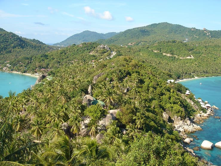
Located on the south side of the island, the John Suwan viewpoint offers gorgeous 360 degree views back across Koh Tao and out to the ocean. From here, you can see the (now iconic) view of Koh Tao’s tree covered peninsula that separates Shark Bay and Chalok Baan Kao bay.
There is an entrance fee of 50 THB to access this trail (this also includes access to both beaches here) and you can park at the entrance.
John Suwan trail description
The John Suwan viewpoint is one of the most popular – and instagrammable – spots on Koh Tao, so expect to be joined by others, especially at sunset. The best time to hike to the viewpoint is early in the morning, when you will have a better chance of having the viewpoint yourself.
I would recommend visiting on a clear, dry day for the best views. Also, it is advisable not to hike the trail when it is raining, or after a heavy downpour as the rocks can become very slippery.
The short, sweaty hike is definitely worth it for the amazing views. So for one of the best day hikes in Thailand, make sure that you don’t miss this viewpoint when visiting Koh Tao!
7. Bottle beach hiking trail, Koh Phangan - Challenging rainforest hike to secluded beach
Distance: 6.6km (total – out and back) / 3.3km one way with taxi boat return
Duration: 1 hour – 1.5 hours each way
Trail category: Challenging
Start / Finish point: Haad Khom Viewpoint car park
Bottle Beach trail overview
This hike was one of the most difficult hikes I completed in Thailand, so make sure you’re up for the challenge before you set off! Most of the challenge was due to the uneven ground and intense heat and humidity, so make sure to take plenty of water. I would also recommend completing this early in the morning, before it gets too hot.
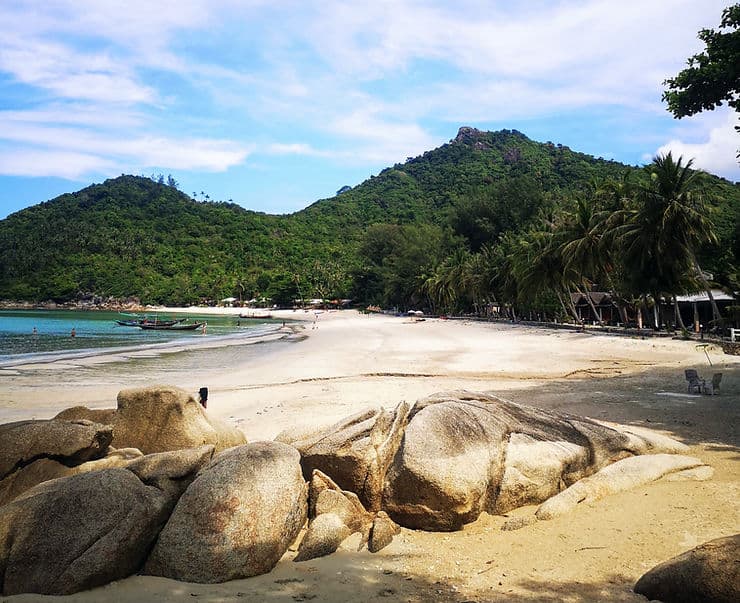
The Bottle beach hiking trail takes you from Haad Khom beach through the rainforest, up and over a mountain and back down the other side to the stunning Bottle beach. The path is very rocky and uneven, with a mixture of forest trails and scrambling over large boulders, so good walking or hiking trainers are a must.
The hike is definitely worth it and Bottle beach is really beautiful. If you are looking to do something different in Koh Phangan, this hike to Bottle beach is a great free activity.
How to get to Bottle Beach
To get to Bottle beach, you will need to head to Haad Khom Viewpoint. There is a small car park for scooters here, or you can get a taxi to drop you off.
From Haad Khom Viewpoint, you have two choices – either hike through the forest to Bottle beach, or walk down to Haad Khom beach to catch a long boat to Bottle beach.
Once you have enjoyed the day at Bottle beach, you’ll need to get back to Haad Khom.
To get back to Haad Khom, you can hike back the same way, or, jump on a taxi boat to Haad Khom beach instead! We paid 150 THB each (£3.50) for the taxi boat and it was a great way to end a fantastic day. Just make sure that you check when the last boat leaves so you don’t get stranded on the beach! When we arrived through the trees onto the beach, there was a lovely local boat driver who we got chatting to straight away and arranged to catch the last boat back with.
Bottle Beach trail description
Finding the start of the trail can be a bit tricky.
Start at the small car park for ‘Haad Khom Viewpoint’. Ignore the trail signs here and walk along the road about 50m until you see a hand written sign on the right side of the road for ‘Bottle beach’. The trail is marked with blue and yellow markings on rocks, or threads hanging from trees. People also leave plastic bottles hanging on trees to mark the route – hence the nickname ‘Bottle beach!’
You will be hiking uphill for the first part of the trail, mostly through thick rainforest (so mosquito spray and / or long trousers and long sleeves are recommended!). You will then arrive at large rocky boulders as you near the viewpoint. Be careful as these are slippery – I would heavily advise against hiking this trail in the wet season or after heavy rain. You don’t actually get much of a view at the viewpoint, which is a shame, but it’s still a nice place to stop and have a rest, with views of the coast through the trees.
The rest of the route is downhill to the beach from here, but be careful as the ground is still very uneven and rocky. This hike is definitely challenging, made even more difficult by the heat – your legs will definitely feel it by the end!
But trust me when I say that once you get your first glimpse of Bottle beach through the trees it will all feel worth it! Bottle beach is one of the most beautiful beaches in Koh Phangan. It can only be accessed by this hiking trail, or by boat, so it is quieter than the other beaches on the island and is pristine. Stay for a few hours and have lunch or a drink at one of the two cafes and cool off in the sea.
8. Phi phi Viewpoint - One of the best short hikes in Thailand
Distance: 1.2km (total – out and back) to viewpoint 2
Duration: 1 hour – 1.5 hours
Trail category: Easy
Start / Finish point: Blu Monkey Phi Phi
Phi Phi Viewpoint trail overview
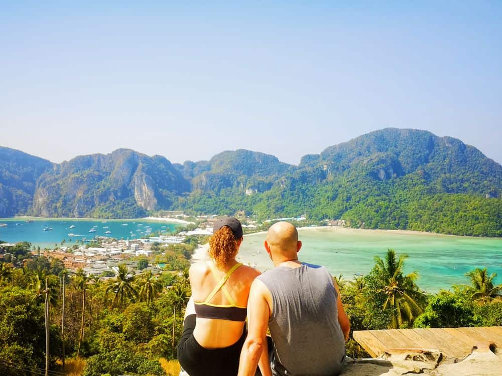
Did you even go to Koh Phi Phi if you didn’t visit the famous Phi Phi viewpoint?! This short hike takes you to the best spot on the island to get a gorgeous Insta-worthy photo.
There’s technically 3 lookouts on this hiking trail, but viewpoint 2 is the most recognisable and definitely the best. In fact, the Phi Phi Viewpoint is one of the best viewpoints in Thailand, in my opinion.
How to get to Phi Phi Viewpoint
The trail starts near the Blu Monkey Phi Phi Island hotel, at the end of the main track running through the centre of town. To the right of the hotel you will see a sign pointing to a set of steps. Once at the top of the steps, you will arrive at viewpoint 1. Here, you will need to pay 30 THB (£0.70) entrance fee (hang on to your ticket as there is another checkpoint between viewpoint 2 and 3 where you may need to show your ticket).
Phi Phi Viewpoint trail description
Viewpoint 1
At viewpoint 1, there’s various eclectic objects in the landscaped gardens, such as giant apples and a rooster(!), and you can take your photo with the ‘I love Phi Phi’ sign. However, the main attraction is the view down to the island and gorgeous blue sea.
Leaving viewpoint 1, follow the path as it winds gently uphill to viewpoint 2 for the best views on Koh Phi Phi! Here, you can see the thin stretch of land between Ton sai beach and Loh Dalum beach, backed by tree covered limestone mountains and surrounded by deep blue sea. This is the iconic view that Koh Phi Phi is so well known for and it is definitely worth the short hike up here!
Viewpoint 2 & 3
Viewpoint 2 offers the best views over Koh Phi Phi bay. Here, you can see the thin stretch of land between Ton sai beach and Loh Dalum beach, backed by tree covered limestone mountains. This is the iconic view that Koh Phi Phi is so well known. And it is definitely worth the short hike up here!
There’s also a couple of cafes at viewpoint 2, so you can stay for a while and really soak up the view.
From viewpoint 2, you can continue a further 10 – 15 minutes on the trail to viewpoint 3. Viewpoint 3 is actually a cafe with a terrace. There’s a 20 THB (£0.45) entry fee to access the terrace, or you can buy a drink instead. It was nice to do the extra hike to this viewpoint, but really viewpoint 2 is the show stopper. Therefore, if you don’t fancy walking this extra section, you’re not really missing out.
Tip: Hiking to the Phi Phi viewpoint 2 is one of the best things to do on Koh Phi Phi, so the trail can get busy. To get the best photos with minimum crowds, arrive early in the morning. This is a really popular spot for watching the sunset, so after you’ve taken your photos during the day, come back in the evening to watch the sun go down. Watching the sunset from this spot is definitely a great way to spend your evening on Phi Phi. Note that no alcohol is allowed on the trail or at the viewpoint. And, there are signs advising that fines will be given for anyone breaking the rules.
9. Long Beach hiking trail, Koh Phi Phi - Short walk to a beautiful beach
Distance: 3km (total – out and back)
Duration: 30-40 minutes each way
Trail category: Easy
Start / Finish point: Carlito’s Bar, Tonsai beach road
Long Beach trail overview
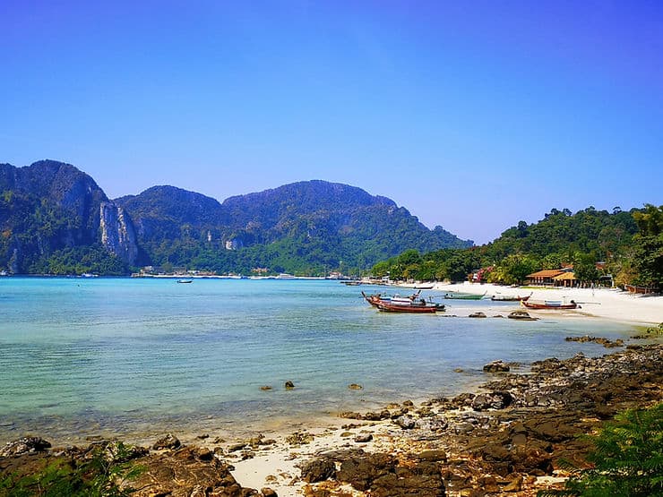
Long beach is a beautiful hidden gem on the island of Koh Phi Phi. Thailand is renowned for its beautiful beaches and Long beach is one of the best beaches on Koh Phi Phi.
The only way to reach Long beach is by walking or longtail boat. If you don’t fancy walking both ways, you could walk to the beach then get a longtail taxi boat back to Tonsai pier. However, I would recommend walking both ways – the walk really isn’t difficult plus, it’s free!
The long, soft sandy beach is not usually busy and you can easily find a quiet spot. The beautiful clear water is great for snorkelling, but there are a few rocks, so be careful swimming when there are waves. There’s also a small mini-mart and a restaurant at Long beach, so you can spend the day here.
How to get to Long Beach
To get to the start of the walk, head away from Tonsai pier, towards Carlito’s bar on Tonsai road. Keep following this road away from the centre of town until the road splits into two. Turn right, past Hippies bar and continue following the road alongside the beach. (If you reach the mosque, you’ve missed the turn to hippies bar and need to go back).
The trail starts from behind the Bayview resort.
Long Beach trail decription
From the Bayview resort, you’ll see a smooth path that skirts the edge of the beach, with beautiful views of the sea. Follow this path until you arrive at the Viking resort. You will walk through the Viking resort (this is a great stop for a drink along the way!) and continue on a trail through the forest. The last section through the forest can be a bit uneven, but it is manageable in sandals as long as you look where you’re going. This walk is best done when the tides are out as you can walk along the beach and over the rocks in some sections.
If you have a couple of days to spend on Koh Phi Phi, a walk to Long beach is a great activity to add to your itinerary. Not only is Long beach a beautiful beach, but the walk to the beach is really picturesque.
Tip: A Lot of people visit Koh Phi Phi on a day trip from Phuket, but I’d really recommend staying on the island for a few days to really experience everything it has to offer.
10. Night jungle trek, Khao Sok National Park - One of the most unique hikes in Thailand
Distance: Various (our trek was only a 3km circular trail)
Duration: Various (our trek lasted 1.5 hours with stopping time to spot wildlife)
Trail category: Easy – Moderate (depending on the tour and trail you take)
Start / Finish point: Khao Sok National Park
Khao Sok Night trek overview
At no.10 on my top 10 unmissable hikes in Thailand is my wildcard entry – a guided night trek in Khao Sok National Park. Maybe not as easily accessible as the other hikes in this post, but I just had to include it.
One of my favourite places I visited during my three months in Thailand was Khao Sok National Park. It’s hard to describe the beauty of this place, it honestly has to be seen first-hand! If you want to see the more natural and untouched side of Thailand, make sure that you add Khao Sok National Park to your Thailand itinerary!
How to get to Khao Sok
Khao Sok is not the easiest place to get to, but it worth the effort. From Krabi or Phuket, you can get book mini-van transport via 12go.
Make sure you also check out my complete Khao Sok National Park guide for all the information you need on how to visit Khao Sok and the famous Cheow Lan Lake.
Khao Sok Night trek description
One of the best things you can do in Khao Sok National park is to join a guided night safari hike. You will need to book onto a tour to access the hiking trails in the national park, or hire a guide.
My husband and I had a night safari hike included in our Grand Jungle package, which we booked as part of our accommodation at Khao Sok Riverside cottages. The night safari was a short 3km circular route, through the rainforest on a mixture of paths and forest trails.
Along the way, our guide informed us about the rainforest and various wildlife that resided here, including bats, spiders, snakes, lizards, frogs and monkeys. The hike was very easy and suitable for all fitness levels – what makes this hike special is the experience of walking through the rainforest in the dark of the night! It was a great evening and I would really recommend it to anyone visiting Khao Sok national Park.
If you don’t fancy walking amongst the creepy crawlies at night, then there are also plenty of daytime guided walks and hikes which you can take within Khao Sok National Park. These range from a couple of hours to full day treks.
Tip: Wear long trousers and long sleeves and take mosquito spray. If you have a torch, take that with you as well. (Your accommodation or guide may have extra for you, so check first).
Safety tips for hiking in Thailand
Take plenty of water
Even on a cloudy day, or on a shaded trail, the temperature can be hot and humid. Don’t underestimate how much water you will need on a hike. Don’t pack just enough, you should always pack more than you think you will need. That way, if you get lost, or have an injury on the trail, you have enough water to keep you going until you find your way or receive help. Don’t rely on being able to buy water when you arrive, make sure that you take some with you, preferably in a reusable water bottle.
Make sure you have an offline map
Whenever I travel abroad, or am going somewhere out of the city, I always make sure that I have an offline google map downloaded onto my phone so that I can navigate even when I lose signal. When I’m hiking I also use the @alltrails app. This app is one of my favourite travel apps. It’s great for finding hiking and walking trails in destinations around the world and the gps tracker in the app is a lifesaver if you lose the trail or are not sure which direction to follow.
You can use the free version, although this requires you to be connected to the internet for it to work properly. So I purchased the pro subscription which is only £35.99 per year and allows me to download maps for offline use. Plus, if you download the alltrails app (free or pro version) using the link in this post, alltrails will plant a tree for each of us too!
Know the emergency numbers
Hopefully nothing bad will happen whilst you’re on the hiking trails, but it is worth knowing what the emergency numbers are just in case. Injuries whilst hiking can be common, especially on rocky and uneven trails, and you may need help getting down.
It is useful to have the phone number of your hostel or accommodation saved in your phone, as well as the number of your taxi driver or tour company (if you used one). But if you need to call the emergency services in Thailand, here are the main numbers:
Ambulance: 1669
Police: 191
Fire: 100
What to wear on hikes in Thailand?
Close toe shoes
It is always best when hiking to wear trainers or hiking shoes. Not only will this give your foot and ankle more support when taking on uneven surfaces, but wearing close toe shoes will protect you from critters hiding in the long grass.
Pack layers
You may not think so, but hiking in Thailand can sometimes get cold! Especially if you are in the north of Thailand, around the mountainous regions of Pai and Chiang Mai. If you are hiking in these areas, it is worth packing layers. I was surprised how cold it was hiking in Doi Inthanon National Park and although I had a long top with me, I wished I had bought a thicker hoodie!
A hat and suncream
At the risk of sounding like your mum, a hat and sunscreen is vital when hiking in Thailand. Even on a cloudy day, you can easily burn, especially if there is a breeze and you can’t feel the heat as much. Also, no-one wants sunstroke to ruin their trip, so make sure that you wear a hat if you are out hiking all day.
Mosquito spray
There’s nothing worse than being bitten to death by pesky mosquitoes. So make sure that you wear good mosquito spray. Or, even better, wear long trousers and long sleeves. Long trousers will also be useful if you are hiking in tropical areas with long grass, as this will also protect you from leeches.


